Bodmin Explorer
With surprising hidden stories at every step.
Intermediate | Steep gradients
Full route: 2 hours, or shortened route: 1 hour 30 mins
Bodmin’s streets are paved with centuries of history. From the Middle Ages to the great industrial era, people have lived, worked, and created here. Their marks are easy to miss, but a slower pace, and a curious eye, reveals so much more.
-


Start
1. Mount Folly Square
Shire Hall
It’s hard to imagine now, but the land surrounding you once belonged to a medieval friary, with gardens and burial plots. The Shire Hall building that now dominates this spot stands on the site of the old friary church. In the 1830s, this church was demolished and an impressive new courtroom building created in its place. For 150 years, the Shire Hall stood at the heart of local justice. This was where some of Cornwall’s most famous criminal cases were tried, and often-harsh sentences passed down.
The Trafalgar Way
As the steps lead down, look around for a plaque. This commemorates the Trafalgar Way: the landmark moment in 1805 when Lieutenant John Lapenotiere arrived with news of victory at Trafalgar and the death of Lord Nelson. Lapenotiere’s incredible journey took him across 1,000 miles of heavy seas in just eight days. His ship, the Pickle, landed in Falmouth on 4th November. From there, he raced to London in just 37 hours, spreading the news as he went. Later in life, he retired to the nearby village of Menheniot, where he’s now buried.
When you’re ready…
Prepare to set off for a walk up historic Fore Street.
-


2. Fore Street
Here, the best views are found high above ground. Take your eyes upwards, and you’ll see that over the modern window displays, a huge amount of original architecture remains. This is the streetscape of years gone by, from traditional shopfronts to Victorian townhouses. There are centuries of stories tucked away here: Fore Street has been Bodmin’s principal street since early medieval times, when it was known as Vostret.
Arnold’s Passage
On your left, look for a small pedestrian passageway, which is named for one of Bodmin’s notable characters. Born nearby in 1736, John Arnold was a celebrated clockmaker, who began his training here in the town. After falling out with his father (who was also a clockmaker), he left Bodmin, never to return.
At 31, Arnold made his name by presenting King George III with a tiny repeating watch, so small it could be set in a ring. He also went on to perfect the maritime chronometer, used by famous explorers like Captain Cook, Dr Livingstone and Ernest Shackleton. Before it was renamed for Arnold, the alley was known as Friary Passage and originally led through the Friary to the burgage plots behind. If you look carefully, you should be able to spot a piece of worked stone in the walls of the passage.
St Petroc’s Guild House
Number 20 Fore Street (now Malcolm Barnecutt’s Bakery) was once home to St Petroc’s Guild House: a meeting point for the St Petroc’s Guild of Skinners and Glovers. This building was partly pulled down in 1502 and replaced with the Bodmin Guildhall you see today. It was probably here, in 1774, that John Wesley preached, arriving in rain and “violent wind” and describing the hall in his journal as “the most dreary one I ever saw”! The coat of arms over the doorway came later; being presented in 1807.
Market House
On your right, look out for some unusual carved bull heads. In 1839, a row of ancient cottages was replaced with a new home for Bodmin’s markets and traders. Instead of being scattered around town, they could be housed under one roof – making this a noisy, bustling spot with butchers’ stalls, fruit and sweet vendors, coopers, ropers, and tin-smiths. Over the years, it’s had many other uses, including a militia meeting place, a cinema, a fire brigade HQ, and a public debating platform. It’s likely both William Gladstone and Winston Churchill made speeches here.
Memorial
Just across the road from Market House, a granite memorial commemorates a Cornish march to London in 1497. Leading the way were the St Keverne blacksmith Michael Joseph, known as An Gof, and a Bodmin lawyer, Thomas Flamank. Protesting against unfair tax rises, they and 15,000 supporters journeyed peacefully to Blackheath, on London’s outskirts. Things wouldn’t end so peacefully, though: 9,000 fought in the battle that followed, and both An Gof and Flamank were captured, charged with treason, and executed at Tyburn.
Chapel An Gansblydhen
The Methodist movement that swept through Cornwall’s towns and villages reached Bodmin in 1743. It arrived with the well-known preacher John Wesley, who came late one August evening after losing his way on Bodmin Moor. Permission for the town’s first Methodist meeting place was granted in 1797, most likely at Chapel Lane. But, with a growing congregation, more space was needed: the present-day Italianate-style building was built in 1839, a century after the movement had begun.
When you’re ready…
Continue up the road until you reach the zebra crossing.
-

3. The Old Library
You’ll find our next stop on the left, on the corner of Robartes Road. Built using local stone in 1897, this former library was the creation of two great Cornish men: philanthropist J Passmore Edwards and architect Silvanus Trevail. Although it’s no longer a library, you’re welcome to pop inside – the building is now home to the creative community hub, intoBodmin. The Old Library Café serves fresh cakes, coffee, and lunches, making this a natural stopping-off point if you’re looking for a rest.
When you're ready...
Walk up Robartes Road and cross Beacon Road, heading towards the Bodmin Beacon Nature Reserve.
-
4. Bodmin Beacon Nature Reserve
Years ago, this tranquil landscape was a setting for local sports. Cricket, rugby and Cornish wrestling matches all took place here (though areas of exposed granite made things more dangerous). Bodmin’s local militia also used the grounds for training – a tradition resurrected just before the Normandy invasion of WWII, when the Beacon was used by American forces practicing tank manoeuvres.
In 1993, peace fell when the land was reimagined as a Local Nature Reserve. Now, the 82-acre site is alive with heathland, hay meadows, fields, and woodlands, creating habitats for a host of wildlife.
When you're ready...
We recommend taking your time exploring the reserve – it’s a great place to sit, eat, and spot wildlife. When it’s time to head back, choose one of the two return routes below. One is more direct, while the other takes a little longer.
RETURN JOURNEY OPTIONS
-
Option 1
Short route back
- Return to the entrance by the car park and walk back down Robartes Road. This time, take a right to Beacon Hill, and another right on to Meadow Place.
- Cut through the Burgage Plots.
- At the long-stay car park, walk to Bodmin Town Museum to find yourself back at Mount Folly. Stay and explore, or venture into the museum itself.
-
Option 2
Full route back
- Head past the monument and picnic benches and down through the meadow, to its bottom right-hand corner. Go through the opening in the stone hedge.
- Turn left along the lane and carry on to the main road. Carefully cross Beacon Road and walk right, until you come to the junction with Harleigh Road. Keep ahead and cross the railway lanes using the pedestrian walkway.
- At the main road turn left along the tree-lined Lostwithiel Road towards Bodmin Keep. If you’ve got time, stop off to range around here – there’s a huge amount to see.
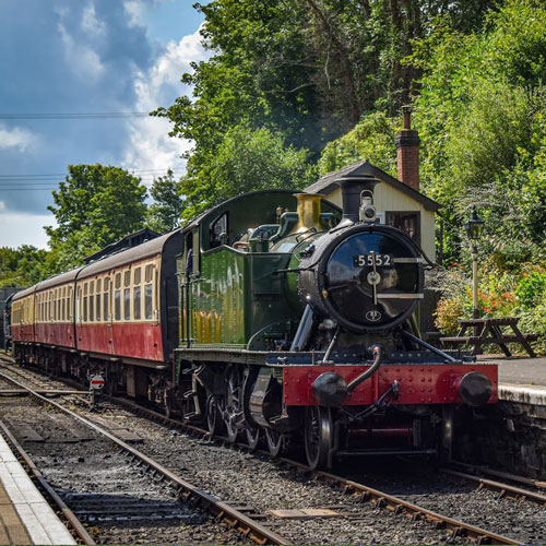
- Cross over by the soldier’s memorial outside the entrance to Bodmin Keep. Pass the Bodmin Railway (or extend your day with a countryside ride) and head down St Nicholas Street.
- Keep an eye out for the foot and cycle path on the right on St Nicholas Street. This will take you past Bodmin Town Football Club, and into Priory Park.
- Walk through the priory car park and cross Crinnicks Hill to reach Mount Folly.